
Ultra trail events
Jurassic Extinction / Jurassic Coast 100
5-6th June 2027
Join us on a journey through 185 million years of history and 105 miles of incredible coastline.
The Jurassic Coast is a World Heritage site that spans from Old Harry Rocks, near Studland to Orcombe Point at Exmouth.
In 2027, you can join us for 33km from Beer to Exmouth, 50 km from Lyme Regis to Exmouth, 100 km from Weymouth to Exmouth, or take on the 105 mile Jurassic Extinction from Poole to Exmouth. We will also be offering an opportunity to start alongside the Jurassic Extinction and run the first 70 km to Nothe Fort in Weymouth!
Our 10 year anniversary edition! (Entries now open)

Event routes
Jurassic Extinction 105 Mile Ultra South west trident qualifier
South west trident qualifier- 8am on 5th June 2027
- South Haven Point (Poole) – Exmouth
- 105 miles
- Height gain 5100m
- Self navigation following the South West Coast Path
- 38 Hours (minimum pace required 5kmph)
- 6 ITRA Points / 100M UTMB Index race
- Live GPS tracking
Jurassic Coast 70Km Ultra
- 8am on 5th June 2027
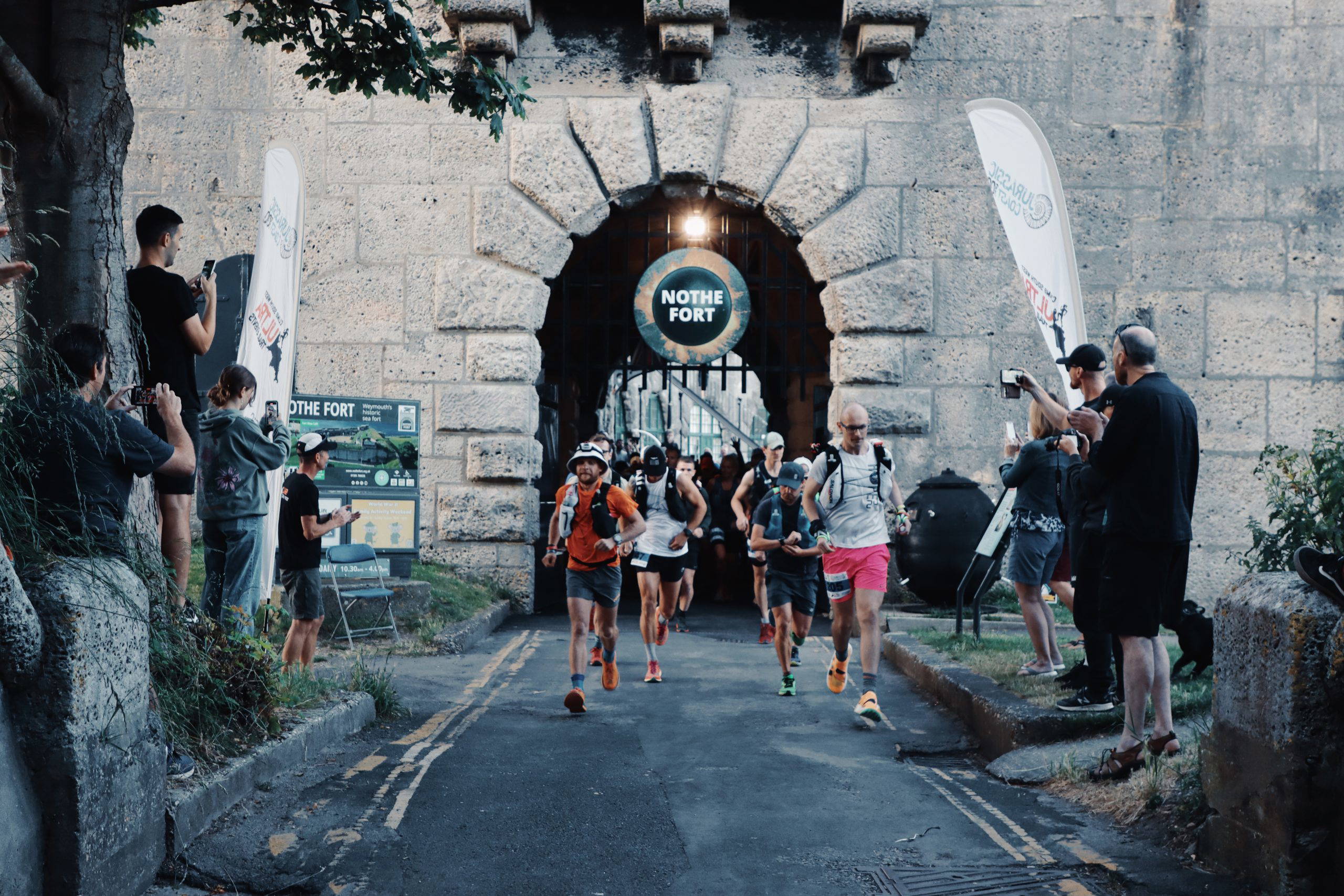
- South Haven Point (Poole) – Nothe Fort (Weymouth)
- 70km
- Height gain 2,200m
- Self navigation following the South West Coast Path
- 14 Hours (minimum pace required 5kmph)
- ITRA Points / UTMB Index race (TBC)
- Live GPS tracking
Jurassic Coast 100Km Ultra
- 9pm on 5th June 2027
- Nothe Fort (Weymouth) – Exmouth
- 100 km
- Height gain 2900m
- Self navigation following the South West Coast Path
- 25 Hours (Open to runners and walkers with minimum pace required 4.2kmph)
- 4 ITRA Points / 100K UTMB Index race
- Live GPS tracking
Jurassic Coast 50Km Ultra
- 8am on 6th June 2027
- Lyme Regis – Exmouth
- 50 km
- Height gain 1730m
- Self navigation following the South West Coast Path
- 14 Hours (Open to runners and walkers with minimum pace required 3.5kmph)
- 2 ITRA Points / 50K UTMB Index race
- Live GPS tracking
Jurassic Coast 33Km Challenge
- 10am on 6th June 2027
- Beer – Exmouth
- 33 km
- Height gain 1050m
- Self navigation following the South West Coast Path
- 12 Hours (Open to runners and walkers with minimum pace required 3.3kmph)
- Live GPS tracking
Looking for other events?
to ultra trail events →
About the event
Jurassic Extinction / Jurassic Coast 100 Event Profile
The Route
The route follows the South West Coast Path national walking trail, marked with an acorn logo. However, this does not mean the whole route is obvious and care should be taken when crossing fields or following sections of road, especially at night. Harvey Map (South West Coast Path 3) covers the whole route: South West Coast Path Map 3 (harveymaps.co.uk) Please note that this is an active section of coastline and small changes are being made to the path on a regular basis. Follow all South West Coast Path and temporary diversion signs. The route is available on Outdoor Active (Jurassic Extinction) and the GPX files for each distance can also be found on our website. You should follow the South West Coast Path markers and any signed temporary diversions, or new path alterations that might be in place. GPS devices should be used as back up only, and some common sense is required. Follow the acorns with the sea on your left. Where a marker has a few arrows, you should follow the one closest to the acorn.
Current Diversions
There are quite a few places along the Jurassic Coast where the path has been moved a couple of meters further inland due to small landslips, but there are also some bigger diversions in place. The bigger diversions have all been included in the route on Outdoor Active and the GPX files.
1. Renscombe CP is about 400m off the Coast Path. A signed diversion will take you out and back.
2. Our West Lulworth checkpoint is away from the coast path. A signed diversion will take you along the Bindon Hill ridgeline and down to West Lulworth village hall. Signs will then lead you back to the coast path.
3. About 2km before you reach West Bay checkpoint, the coast path has been closed. Follow the signed footpath over the golf course instead. This has now become the new route for the South West Coast Path.
Your Safety
This is our primary focus at all our events. The Climb South West safety team are all professionally qualified outdoor specialists, with vast experience in managing groups of people engaged in adventurous outdoor activities. They will be on hand at all checkpoints, providing first aid cover and support where it’s needed most. We will also have mobile units out on the course, should there be a problem in between these locations. Please take extreme care on all sections with unfenced cliff edges. Keep away from landslips and follow all temporary diversion signs.
Livestock on the course. You are likely to pass through a few fields with livestock. If they are on the path, please approach slowly to give them time to get out of your way.
If a member of the Climb South West Team decides that it isn’t in your interest to continue with the event for any reason, please accept this decision.
Should you need to leave the event early, and can’t be picked up, we can drop you off at a suitable bus stop in one of the coastal towns. If this is at night, we can move you forwards to the next indoor checkpoint. This is not a lift back to your car.
Volunteering
We welcome help from volunteers at all our events, to support the work of our team. If you know anyone who is interested in getting involved, please ask them to contact us directly. We can offer free/discounted entries on future Climb South West events in return for their time.
Support crew
Although this is a supported event with checkpoints and safety cover, some of you may wish to use a support team to meet you at various points along the route. They can arrange to meet you as often as required, but we ask that they do not join you for sections of the route, unless it’s an emergency. The only exception to this is between 9pm and 7am. If you choose, you may have someone accompany you overnight. However, checkpoint food and drink is for participants only.
Ideally, support crews will meet you in locations between our checkpoints. Further details below. Crews will not be permitted to enter any of the indoor checkpoints this year.
Some car parks are locked overnight. Please check before parking up!
Pre-event transport
Transport is available to each of the start locations as detailed below. This must be booked in advance through your SiEntries account.
Please note, there is no return transport after the event.
Transport available:
Jurassic Extinction 105 miles-Exmouth to Shell Bay
Jurassic Coast 70km-Weymouth to Shell Bay
Jurassic Coast 100km-Exmouth to Weymouth
Jurassic Coast 50km-Exmouth to Lyme Regis
Jurassic Coast 33km-Exmouth to Beer
Event results
Results
Fastest times:
Jurassic Extinction 120 miles: Daryl Smith (M) 30:27:29 / Simone Durry (F) 32:10:48
100 Miles: Daniel Miller (M) 21:24:00 / Linn Erixon Sahlstrom (F) 26:37:00
100 Km: Michal Lesniak (M) 10:47:51 / Alice Kelly (F) 12:33:05
70Km: Sam Pattison (M) 7:38:46 / Hannah Rickman (F) 7:39:58
50 Km: Liam Storey (M) 4:30:00 / Charlie Ramsdale (F) 5:30:30
30 Km: Martin Reynolds (M) 2:54:54 / Kirsteen Welch (F) 3:13:00








Contact us
Get In Touch
Got a question about an event? Need to know if you’re ready for one of our longer races? Just ask.